

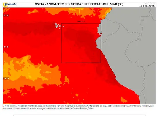
Peru’s El Niño monitoring commission says coastal El Niño is expected to remain at extraordinary strength through February 2027, with the effects of the warming likely to be felt in rainfall, river flows and coastal conditions. The commission also expects very strong El Niño conditions in the central Pacific to last through February.
The forecast, issued by the Multisectoral Commission for the Study of the El Niño Phenomenon (Enfen) on November 13, comes as a separate report citing NOAA’s November 12 assessment says strong-to-very-strong conditions could persist into early 2027. That assessment put the chance of the event reaching historic strength at about 60% under one measure, compared with El Niño events recorded since 1950.
El Niño is a natural climate pattern in which weakened or reversed Pacific trade winds allow warmer water to shift east, releasing heat into the atmosphere and influencing weather around the world. Enfen’s outlook concerns two Pacific regions: coastal waters off Peru and the central Pacific.
Heavy rain and high river flows forecast in Peru
From November through January, Enfen expects above-normal rainfall on Peru’s north coast, western northern highlands, central coast and western central highlands. Episodes of moderate to heavy rain could become more frequent or intense, particularly on the north coast. For the 2027 summer, the commission expects above-normal rain along the entire coast and in the western northern and central highlands, again with the strongest and most frequent rain on the north coast.
Enfen also forecasts above-normal flows in northern coastal rivers including the Tumbes, Chira, Piura, La Leche and Jequetepeque, with flows in the Tumbes and Piura expected to be far above normal. From January, the trend could extend to rivers on the central and southern coast, including the Rímac, Lurín, Pisco and Ica. By contrast, flows in rivers feeding Lake Titicaca are expected to remain below normal, affecting the lake’s recovery.
The commission expects temperatures to be well above usual along Peru’s entire coast, with new records possible toward summer. Sea levels are forecast to stay above the average, especially in the north. Enfen also sees a greater chance of potentially more impactful swells from the north in December and January. Combined with higher sea levels, these conditions could increase flooding and erosion risks on low-gradient beaches.
Outlook points to regional contrasts in North America
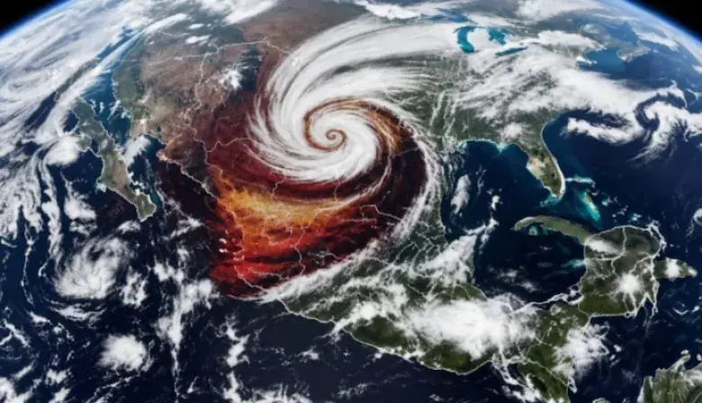
Forecasts cited in a report drawing on BBC reporting point to increased rainfall across much of California, the Southwest, the Central and Southern Plains, the Southeast and parts of the eastern seaboard. Florida and other southeastern states could be particularly wet; California could face heavier rain, flooding and mudslides, especially in areas affected by previous wildfires. The report also notes that rainfall intensity and location will vary.
Warmer-than-average winter temperatures are forecast in parts of Alaska, the western United States and northern regions, while below-average precipitation is expected in areas including the Northern Rockies and parts of the Great Lakes. Enfen urged people in areas exposed to heavy rain, floods and landslides to strengthen home protections and follow local authorities’ advice. Its next official communiqué is due on November 30.


Comments
To comment, sign in or create an account. Sign in Create an account
No comments yet.